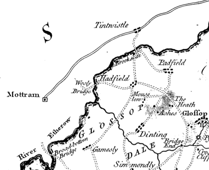
Burdett's map of 1791
A section of P.P. Burdett's map of 1791 shows Padfield as just a few minor dwellings where Padfield Main Road now lies.
The solid and dashed parallel lines show the River Etherow, which marks the boundary between Cheshire and Derbyshire. Details on the Cheshire side have not been completed and simply show the main thoroughfare through Tintwistle up to Mottram.
Padfield Main Road, seen as double dotted lines ==== connects another road, presumably lines roughly following Temple Street and Redgate, with that of Park Road that leads through the then small village of Hadfield, which is prominently marked as is Tintwistle and Mottram. This section of the map bears a striking resemblance to Stockdale's map of 1794, without the colour and detail on northern and western side of the Etherow.
At the time this map was produced, construction on the reservoirs have not yet begun. The first of which will be the Woodhead Reservoir in August 1848, followed by Rhodeswood, Torside, Anfield and Hollingworth reservoirs between in 1849. Valehouse and Bottoms are later additions with construction commencing in July 1865 and November 1867 respectively.
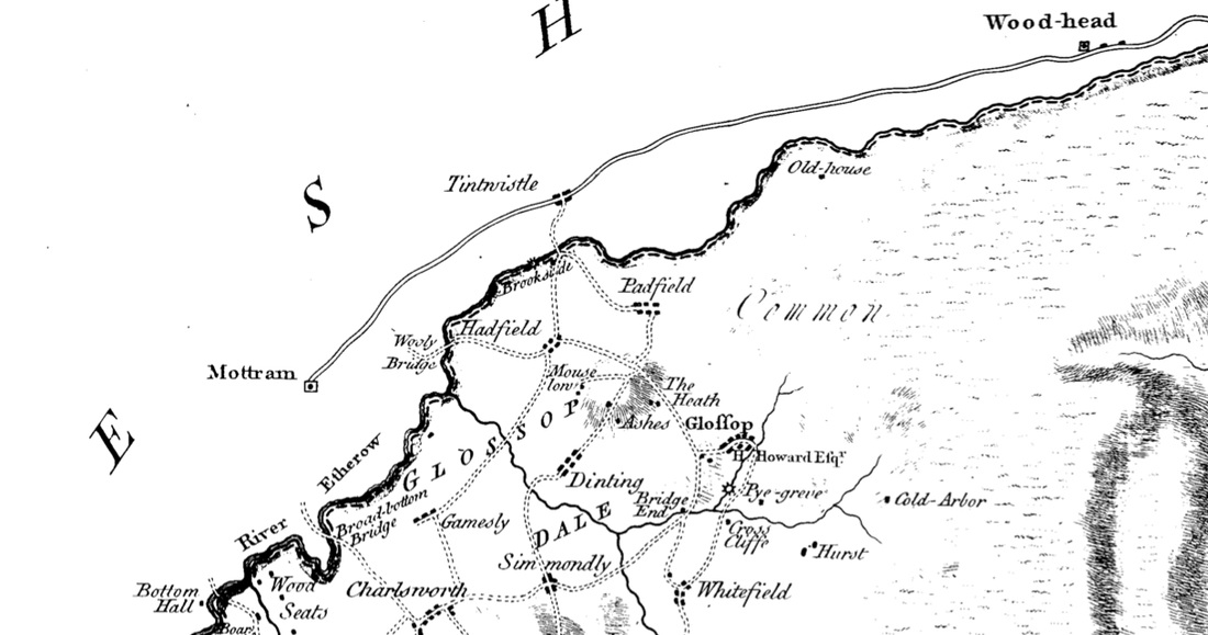
Map courtesy of Glossop Heritage Trust
Map courtesy of Glossop Heritage Trust