Where we are located
Padfield lies on a sloping prominence adjacent to Hadfield and is approximately 1.5 miles from the centre of Glossop.
There is a good rail link to Manchester Piccadilly, running on a half hourly basis. The closest railway station is approximately 1/2 mile away, located at the top of Station Road, opposite The Palatine Pub in Hadfield. Travel time to Manchester is 40 minutes.
There is a good rail link to Manchester Piccadilly, running on a half hourly basis. The closest railway station is approximately 1/2 mile away, located at the top of Station Road, opposite The Palatine Pub in Hadfield. Travel time to Manchester is 40 minutes.
Within the Village
Because of the village's location, its proximity to the National Park and the Mill Pond on Platt Street, there is plenty of wildlife to be seen if you know what you are looking for and where to look for it. In addition to this, the majority of Padfield lies within the boundaries of a conservation area that was first designated on 27 April, 1994.
At the lower end of Platt Street you will find the start of the Longdendale Trail, with its peaceful surroundings as it opens out onto the Longdendale Valley and chain of reservoirs leading all the way to the Woodehead Tunnel. The trail is a very popular spot for walkers, joggers, cyclists and horse riders alike and can get busy at times, but the views on offer certainly make any amble or more energetic outing worthwhile.
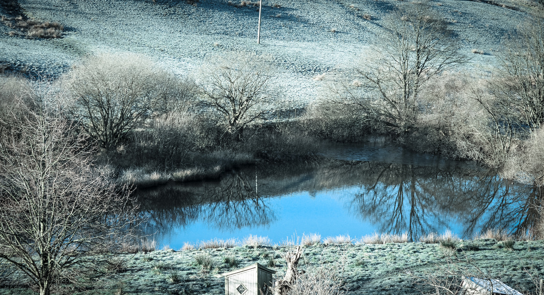
The mill pond on Platt Street on a frosty morning
If you need a place of worship, you will find the Padfield Independent Chapel on Temple Street and the village has its own Community Primary School, located on Rhodes Street, halfway up Post Street.
Also on Platt Street there is the locally famous Laughing Badger Gallery, with its workshops, award-winning food and gallery displays from the works of local artists; it's enough to whet anyone's appetite!
The only drinking establishment in the village is the Peels Arms pub, located at the top of Temple Street at the junction with Padfield Main Road. Here you will find a spot for food and drink popular with locals and visitors to the village, passing through after a day's walk along the trail. Most meal times are busy so it's advisable to book in advance to secure a table.
Whilst Padfield doesn't have a Parish Councillor, there are four other tiers of elected representatives, ranging from the Borough Councillor through to the Member of Parliament for the High Peak. These contacts are particularly useful if you have any village-based concerns, especially in light of the housing proposals nearby, that require the attention of both High Peak Council and Derbyshire County Council.
Padfield is the first 20mph speed limit ever in the whole of Derbyshire and will be used as a trial by the council to decide if other places in the county will follow suit. If you drive through the village please remember that 20's Plenty!
Padfield is the first 20mph speed limit ever in the whole of Derbyshire and will be used as a trial by the council to decide if other places in the county will follow suit. If you drive through the village please remember that 20's Plenty!

Other useful information
- The postcode for Padfield is SK13.
- The telephone area code is (0)1457 or for international callers the code is +44 1457.
- There are two postboxes in Padfield: one located in the wall of 95 Platt Street and the other on the corner of the recreation ground adjacent to Temple Street, near the notice board.
- The nearest doctors' surgeries and dentists are in Hadfield, please see the Useful Contacts page for details.
- There are two defibbrillators in the village, one in the telephone box opposite 11 Platt Street, and the other outside the Chapel
- The bin collection dates can be obtained by inputting your postcode into the query box on the Bin Day Checker page on the High Peak Borough Council website.
- The Padfield area has several elected representatives.
- The nearest Post Office is located at 120-122 Station Road in Hadfield. Post collections now from Hollingworth Village Store.
- The nearest library is located on the middle floor of Hadfield Hall, at the junction with Station Road and Railway Street in Hadfield.
- There is a community bus (No. 393) run by High Peak Buses, which operates Monday to Saturday. The route includes Padfield, Glossop and Shirebrook as a circular, taking approximately one hour, depending on time of day. Click on the timetable for current times.
- GPS coordinates for Padfield Main Road between Post Street and Temple Street junctions:
- Degrees, Minutes, Seconds: 53°27'48.6"N 1°57'21.7"W
- Decimal Degrees: Lat 53.463490, Long -1.956035
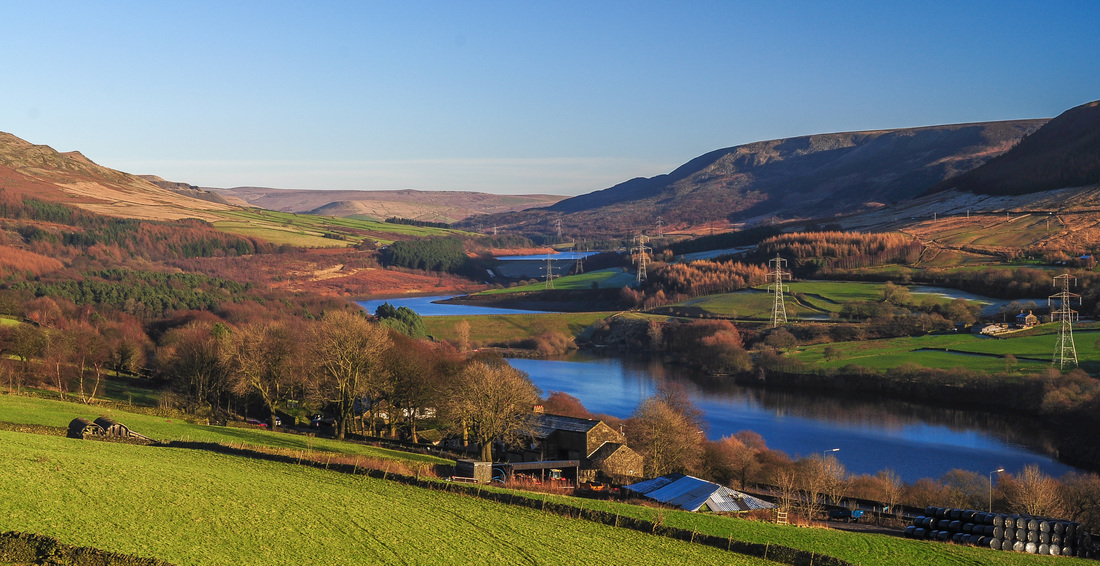
The Longdendale Valley and reservoirs as seen from Tintwistle.