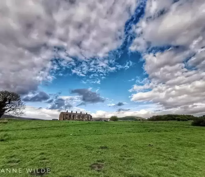
Padfield Village
  • Home
    • About
    • Contact Us
    • Search
    • Contributors
  • Community
    • News
    • Announcements
    • Local Government Reorganisation
    • Residents' Society
    • Padfield Community Spaces (PCS)
    • Primary School
    • Congregational Chapel
    • Tuesday Club
    • Peels Arms Pub
    • Hadfield with Padfield Wi
    • Support in the Community
  • What's On
    • Events & Activities >
      • Christmas Fayre
      • Coal Race 2024
      • Floral Competition
      • Padfield Lottery
    • Shared Event Calendar
  • Location
    • Local Wildlife
    • Longdendale Trail
    • Conservation Area >
      • Local Green Space
    • Roughfields >
      • About Save Roughfields
    • Speed Restriction
    • Elected Representatives
    • The Local Plan
    • Travel >
      • Bus information
      • Traffic & Roadworks
      • A57 Link Road
      • Rail transport
    • Useful Contacts
    • Useful links
  • History
    • Padfield Name Definition
    • Brief History of Padfield
    • History Timeline
    • Padfield 1901 Census >
      • 1901 Census Transcript
      • Old Occupations & Definitions
    • Historic Maps >
      • Runnat Intack map 1763
      • Burdett's map 1791
      • Stockdale's map 1794
      • Poor Law map 1857
  • Gallery
    • Padfield's Past
    • Padfield Today
    • Padfield Spring
    • Padfield Winter
    • Padfield Snow
    • Local Wildlife
    • Padfield and Environs
    • Longdendale Winter
    • Photo Calendar
  • Publications
  • Guest Book

Roughfields

Picture

Picture

Roughfields

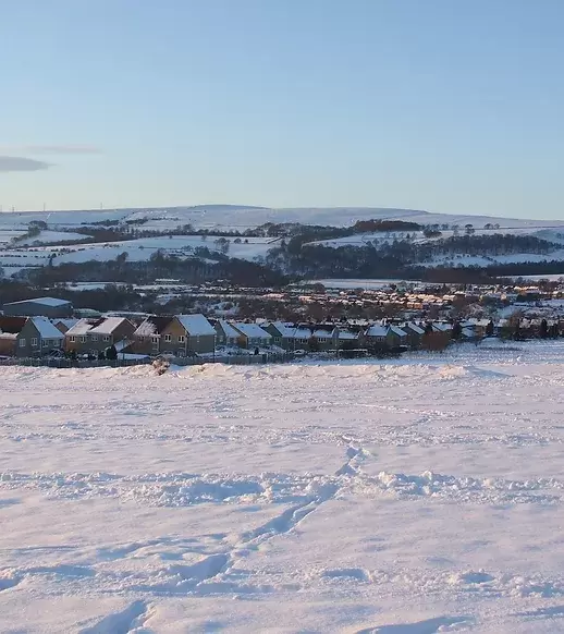
Roughfields is an area of land (4.7 ha, 11.5 acres) South of Padfield Main Road, between Padfield village and Brosscroft.

It is the last remaining area of public open green space at the NE end of Hadfield, vital to the physical and mental wellbeing of the local community.

The land was earmarked in the 1950s for Manchester overspill housing (with DCC agreement).  But, since then, life has changed dramatically: the population of Glossopdale has doubled; car ownership has sky‑rocketed; yet infrastructure capacity and public amenities have not grown accordingly. Indeed, many local services have disappeared, to be delivered only in larger centres of population.

In the 2016 Local Plan, HPBC (belatedly) allocated Roughfields as a potential site for 102 new houses. Padfield Main Road, narrow and with no pavement, would be the main access.

In 2023, Roughfields HPBC designated Roughfields an Asset of Community Value, officially confirming its importance to the public.


Picture

Save Roughfields

The Save Roughfields campaign began in December 2020 after residents discovered that the site was part of the High Peak Borough Council's (HPBC) "Local Plan" and had been given "accelerated status" for the development of 102 houses and  a new primary school. The community came together and within weeks of starting up the Save Roughfields  FaceBook page, we had over one thousand members.
​
Roughfields as it currently stands is our final piece of accessible amenity green space between the two villages of Hadfield and Padfield situated in the Dark Peak. The majority of this former farmland has been developed into housing estates over recent years.
 
Previous campaigns managed to save this current stretch of Roughfields, however as it now stands, we could lose  our last piece of Roughfields to a developer at any moment.

Our Aim

Save Roughfields is a group of like minded people who are passionate about keeping the High Peak green and protecting our open spaces.
 
We are an independent group of volunteers, we are not affiliated to any political parties.

Our sole aim is to unite our community and Save Roughfields for the benefit of all living things and their future generations.

The immediate objective is to have Roughfields removed from the housing allocations in the Local Plan, which is currently being reviewed. 
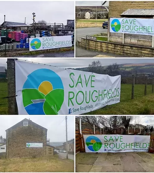
Picture

Local support

Save Roughfields is built on a strong foundation of community, with a real sense of wanting to protect the last piece of accessible amenity green space we have between our two villages.

​Take a walk or drive around the area and you won't have to go far before you'll see "Save Roughfields"  posters in front windows, campaign banners attached to fences and people wearing their "Save Roughfields" campaign badges.

Picture
Picture

Roughfields Community Project

Address:
4 Malvern Rise, Hadfield, GLOSSOP  SK13 1QW
Mail: [email protected]
Tel: 07714 323089

To keep up with key events please subscribe below

    Subscribe to updates

Subscribe to updates
For All Enquiries Please Contact
[email protected]
COMMUNITY
News
Local Gov.  Reorganisation
Residents' Society
Padfield Community Spaces
Community School
Congregational Chapel
EVENTS & ACTIVITIES
Events & Activities
Padfield Women's Institute
Coal Race
Floral Competition
Padfield Lottery
LOCATION
Books & Publications
Local Wildlife
Longdendale Trail
Conservation Area
Speed Restriction
Useful Contacts
Useful Links
GALLERIES
Padfield's Past
Padfield Today
Padfield Spring
Padfield Winter
Longdendale Snow
HISTORY
Padfield Name Defintion
Brief History of Padfield
Padfield 1901 Census
Old Occupations
Historic Maps
MISCELLANEOUS
Padfield Village News
Guest Book
FIND OUT MORE
About Us

Contributors
Archives
GET IN TOUCH
​Contact Us
​
[email protected]


​
© 2015 - 2023
Padfield Residents' Society.
Padfield, Derbyshire, UK.

  • Home
    • About
    • Contact Us
    • Search
    • Contributors
  • Community
    • News
    • Announcements
    • Local Government Reorganisation
    • Residents' Society
    • Padfield Community Spaces (PCS)
    • Primary School
    • Congregational Chapel
    • Tuesday Club
    • Peels Arms Pub
    • Hadfield with Padfield Wi
    • Support in the Community
  • What's On
    • Events & Activities >
      • Christmas Fayre
      • Coal Race 2024
      • Floral Competition
      • Padfield Lottery
    • Shared Event Calendar
  • Location
    • Local Wildlife
    • Longdendale Trail
    • Conservation Area >
      • Local Green Space
    • Roughfields >
      • About Save Roughfields
    • Speed Restriction
    • Elected Representatives
    • The Local Plan
    • Travel >
      • Bus information
      • Traffic & Roadworks
      • A57 Link Road
      • Rail transport
    • Useful Contacts
    • Useful links
  • History
    • Padfield Name Definition
    • Brief History of Padfield
    • History Timeline
    • Padfield 1901 Census >
      • 1901 Census Transcript
      • Old Occupations & Definitions
    • Historic Maps >
      • Runnat Intack map 1763
      • Burdett's map 1791
      • Stockdale's map 1794
      • Poor Law map 1857
  • Gallery
    • Padfield's Past
    • Padfield Today
    • Padfield Spring
    • Padfield Winter
    • Padfield Snow
    • Local Wildlife
    • Padfield and Environs
    • Longdendale Winter
    • Photo Calendar
  • Publications
  • Guest Book