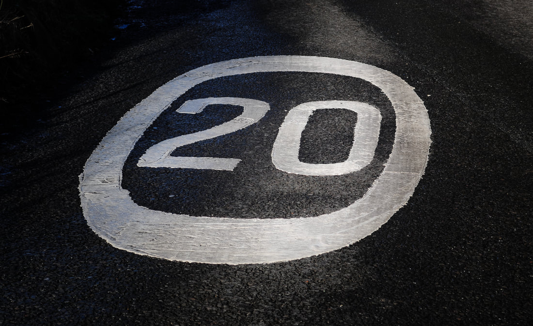
New 20mph speed limit
For such a small village, we often seem to get a lot of traffic, sometimes going faster than it should! This is particularly worrying when you consider:
Therefore, the Residents' Society are pleased that, after many years of campaigning, Derbyshire County Council have finally brought in a new 20mph speed limit throughout the majority of the village; helping to make the village safer. This was the first 20mph speed limit ever in the whole of Derbyshire and will be used as a trial by the council to decide if other places in the county will follow suit. Please note, this is not yet a permanent feature and is currently running for a trial period.
- The number of children around the play area on Temple Street;
- Our Primary School;
- Residents going about their business;
- The high number of walkers, cyclists and even horse riders passing through the village on a regular basis.
Therefore, the Residents' Society are pleased that, after many years of campaigning, Derbyshire County Council have finally brought in a new 20mph speed limit throughout the majority of the village; helping to make the village safer. This was the first 20mph speed limit ever in the whole of Derbyshire and will be used as a trial by the council to decide if other places in the county will follow suit. Please note, this is not yet a permanent feature and is currently running for a trial period.

Credit: Derbyshire County Council
There is still a major concern regarding drivers who are still driving too fast throughout the village, particularly on Padfield Main Road and Platt Street, although Post Street and Temple Street too have seen drivers continually flouting the speed limit. The village is currently within a 20 mph speed limit, which means at no point throughout the village at any time (not just school run times) should any driver be travelling in excess of 20 mph. It really isn't difficult to comprehend.
Let's have a look at the difference between a 20 mph zone and a 20 mph limit. Firstly, legally, the former is exactly the same with regards to the speed, or rather the maximum speed in which vehicle users are allowed to drive at. This is a maximum of 20 mph, however, there are other differences between the two that should be made more apparent. The main difference between a 20 mph zone and 20 mph limit boils down to traffic calming (the former) and signage (the latter).
20 mph Zones
A 20 mph zone usually has some form of traffic calming measures in place, i.e., speed bumps or road narrowing etc. Within the "zone" traffic calming measures are used at no more than 50m intervals - in other words, no point in the "zone" is further than a maximum of 50m from any form of traffic calming feature. In addition to this the zone is clearly indicated by 20mph signage at point of entry/exit. Because of traffic calming measures in place there is no need for additional signage within the zone.
20 mph Limits
A 20 mph limit is different whereby signage is not only located at entry/exit points, but also further "repeater" signage is placed through the speed limit area at regular intervals to remind vehicle users they are still driving within a 20 mph limit area. Because of this there are no traffic calming measures in place although they can be added if required.
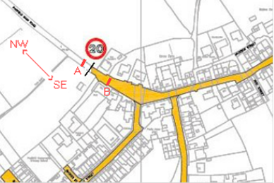
Roads within the 20mph speed limit
|
|
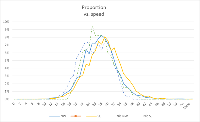
Proportion vs Speed data
Local resident Nic Holt created the graph below based on measurement data by Derbyshire County Council. In addition to this data Nic included his own measurements from data collected with a Bushnell radar speed gun. The DCC measurements were taken just outside the 20 mph limit on Padfield Main Road and, as a result of this, please be aware that there are no officially conducted measurements taken inside the 20 mph limit at this particular location.
|
Notes about the map and graph -
|
Credit: Derbyshire County Council
|
The graph below represents data collected and amalgamated to provide a proportion vs speed result for vehicles travelling in both directions - into and out of the village, as seen in the image above. The results are hardly surprising considering the high number of vehicle users driving at speeds well in excess of the 20 mph speed limit. Every person driving at a speed in excess of 20 mph within the designated speed limit area is breaking the law.
Credit: Nic Holt
Inside the 20 mph limit only:
- 10% of vehicles observe the 20 mph speed limit;
- 80% of vehicles travel at 30 mph or less;
- 20% of vehicles exceed 30 mph;
- A few vehicles travel in excess of 40 mph.
Please slow down! Thank you.